VATX
Aug22–26
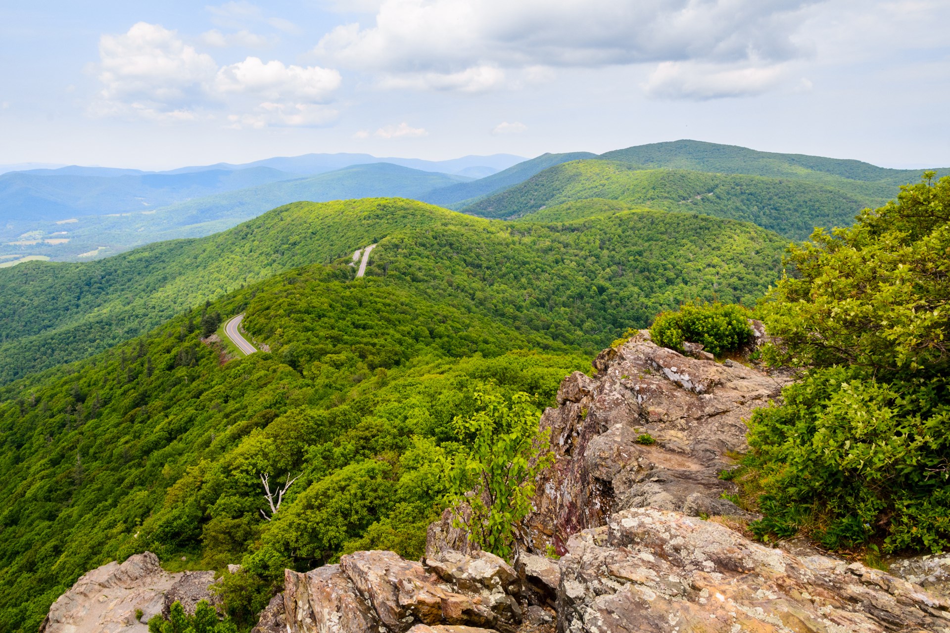
Blue Ridge Mountains from Skyline Drive

August 22–26 · Five days · Four powered camps

McLean
to Dallas

1,550 miles of Blue Ridge morning light, quiet parkways, lake evenings and small-town Texas—built around a 200-mile working range and a firm Wednesday arrival.

5days
4powered camps
25mapped stops
WedDallas arrival

The route

One memorable cluster each day. Camp before the evening is gone.

The full Skyline drive remains the centerpiece. US-11, the Natchez Trace, Scenic 7 and TX-11 add texture without making any scenic segment mandatory. Every day has a direct-road bailout, and every campsite is an actual destination rather than a late-night parking space.

Live route weather

Follow the forecast down the road.

Updating…

Retrieving the latest model run

Day 1 · 2026-08-22 · Morning

Big Meadows

Breakfast, restrooms, and the central Skyline stop

Loading this stop’s forecast…

Forecasts are model guidance, not emergency alerts. Recheck the morning of each drive and obey park closures or official warnings.

Data: Open-Meteo Best Match ↗

Interactive route

The entire drive, one stop at a time.

Select a day to isolate its route, or tap any numbered stop to fly in. Pinch, drag, and zoom freely; every stop also opens directly in Google Maps.

Drawing the full route…
01SaturdayThe full crest of Shenandoah in morning light02SundayValley roads, a two-state downtown, and Center Hill Lake03MondayA compact, quiet section of the Trace and railroad Americana04TuesdayBathhouse Row at opening and the Ouachita foothills05WednesdayPiney Woods, a curious Texas square, and an early finish

Full itinerary

Morning scenery. Midday charging. Early camp.

Skyline Drive winding through the Blue Ridge Mountains

Day 1 · Saturday, August 22

McLean → Skyline Drive → Claytor Lake

The full crest of Shenandoah in morning light

Photo: KOA / Shenandoah itinerary
Depart5:15 AM ET
Arrive3:45–4:30 PM
Distance365–380 mi
Day length10½–11 hr total
TimeEastern
5:15 AM

Leave McLean at 100%

Load the complete route before departure: Strasburg Supercharger, Front Royal Entrance Station, Big Meadows, Rockfish Gap, Stuarts Draft Supercharger, then Claytor Lake State Park.

6:25–7:00 AM

Strasburg Supercharger

119 Hite Lane. Charge to 95–100%. Leave only when the Trip Energy graph predicts at least 25% at Stuarts Draft after the full Skyline route.

7:20–11:45 AM

Skyline Drive

Enter at Front Royal and keep the stops deliberately short. The 105-mile road has a 35 mph limit and normally takes about three hours before stops.

  • Hogback Overlook · 5–10 minutes
  • Hazel Mountain or Marys Rock Tunnel · 5 minutes
  • Big Meadows · 20–30 minutes for breakfast and restrooms
  • One southern overlook · 5–10 minutes
12:15–1:00 PM

Stuarts Draft Supercharger + lunch

Charge while eating the packed lunch. Require at least 30% predicted arrival at Claytor Lake; prefer 35% if Camp Mode will run before the pedestal is connected.

3:45–4:30 PM

Claytor Lake State Park · Birch B22

Go directly to the booked electric/water campsite and plug in. Shower, eat at camp, walk the lakeshore for 20–30 minutes, then settle in near the water through sunset.

Swift Run Gap decision point · MP 65.5
  • Exit toward Harrisonburg if Stuarts Draft falls below 25% predicted arrival.
  • Exit for thunderstorms, poor visibility, or a Claytor ETA later than 5:30 PM.
  • Use the Harrisonburg 250 kW Supercharger, then transition directly to I-81.

Open complete day route
The illuminated Bristol Virginia Tennessee sign

Day 2 · Sunday, August 23

Claytor Lake → Bristol → Floating Mill

Valley roads, a two-state downtown, and Center Hill Lake

Photo: Southern Living / Yahoo
Depart7:00 AM ET
Arrive3:45–4:30 PM CT
Distance330–345 mi
Day length≈ 8½ hr total
TimeEastern → Central
7:00 AM ET

Leave Claytor at 95–100%

Take US-11 through Pulaski and Wytheville, I-81 toward Abingdon, then return to US-11 for the final approach into Bristol. This keeps the attractive valley sections without committing to every commercial mile.

9:30–10:20 AM

Bristol charge + State Street

Charge high enough for Crossville with at least 25% predicted arrival. Make a short downtown loop for the Virginia–Tennessee state line and the Bristol sign before continuing west.

12:15–1:00 PM CT

Crossville Buc-ee’s charge + lunch

Stop at 2045 Genesis Road for the planned meal, restroom and charging break. Tesla lists 16 on-site Superchargers at up to 250 kW, available 24/7. Charge for at least 25% predicted arrival at Floating Mill; you gain an hour after crossing into Central Time.

3:45–4:30 PM CT

Floating Mill Park · Site 009

Plug in at the booked lake-edge vehicle site, then keep the evening entirely at Center Hill Lake: waterfront walk, optional swim if open, campsite dinner, and sunset.

Protect the lake evening
  • After a 7:45 AM departure, use I-81 from Claytor to Abingdon and retain only the final US-11 approach.
  • Keep Bristol, but shorten the downtown walk to a photo stop.
  • Knoxville remains the early fallback; Cookeville is the final Supercharger fallback before Floating Mill.
Open complete day route
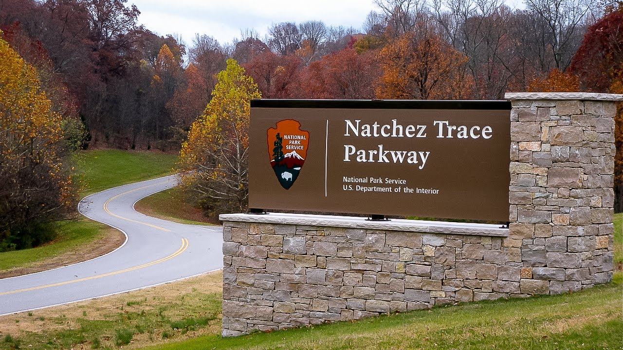
A curving woodland road on the Natchez Trace Parkway

Day 3 · Monday, August 24

Floating Mill → Natchez Trace → Village Creek

A compact, quiet section of the Trace and railroad Americana

Photo: TheTravelShots
Depart6:30 AM CT
Arrive4:00–5:00 PM
Distance350–370 mi
Day length≈ 9 hr total
TimeCentral
6:30 AM

Leave Floating Mill at 95–100%

Head west to Dickson rather than approaching the closed northern end of the Natchez Trace.

8:00–8:40 AM

Dickson Supercharger

Charge high—normally 90–95%—because the next leg combines the Trace, Hohenwald and Jackson. Set the complete scenic route before leaving.

9:10 AM–12:15 PM

Natchez Trace · enter near MP 429

Approach via TN-46, south of the Double Arch Bridge closure. Drive only the strongest compact sequence and skip the steep Jackson Falls descent.

  • Garrison Creek · MP 427.6 · 10 minutes
  • Water Valley Overlook MP 411.8 or Baker Bluff MP 405.1 · choose one
  • Meriwether Lewis · MP 385.9 · 15–20 minutes
12:30–1:30 PM

Casey Jones Village + Jackson Supercharger

Charge and eat lunch together. Spend 10–15 minutes with the village and outdoor railroad displays, then leave with 30–35% predicted arrival at Village Creek.

4:00–5:00 PM

Village Creek State Park · Site 33

Arrive well before the dusk gate, go directly to the booked full-hookup site and plug in immediately. Shower and eat first; wait for the temperature to fall before a short campground or lakeside walk.

Dusk-gate protection
  • Skip the Trace after a 9:15 AM Dickson departure or a Village Creek ETA later than 6:00 PM.
  • If Jackson falls below 25%, add the 325 kW Wildersville Supercharger after leaving the Trace.
  • Use direct I-40 whenever weather, fatigue, or schedule makes the scenic segment uncertain.
Open complete day route
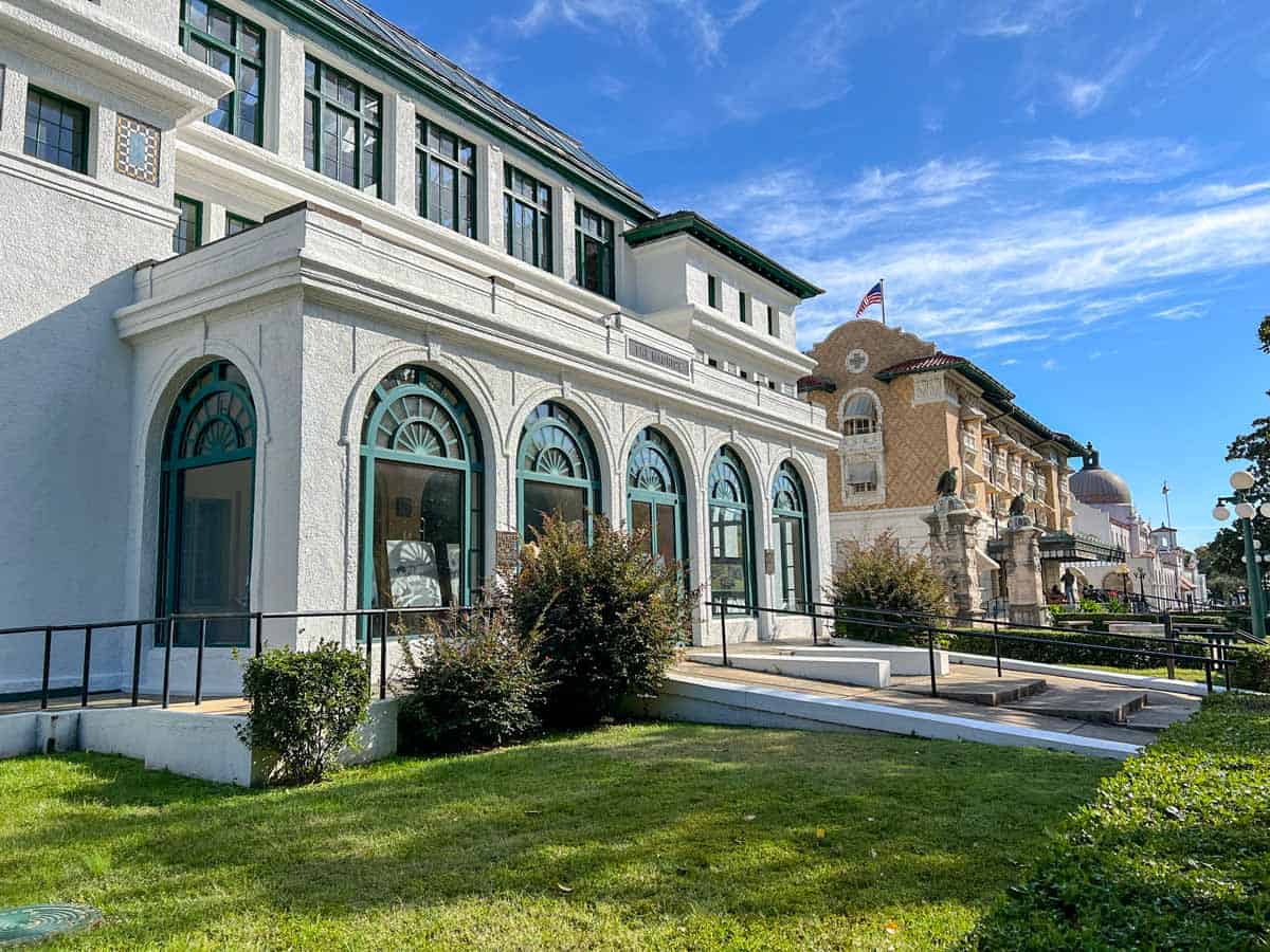
Historic Bathhouse Row at Hot Springs National Park

Day 4 · Tuesday, August 25

Village Creek → Hot Springs → Daingerfield State Park

Bathhouse Row at opening and the Ouachita foothills

Photo: The Happiness Function
Depart6:15 AM CT
Arrive4:00–5:00 PM
Distance345–365 mi
Day length9–10 hr total
TimeCentral
6:15 AM

Leave Village Creek at 95–100%

The early departure puts every meaningful outdoor stop before the hottest part of the day.

7:45–8:15 AM

Little Rock Supercharger

Make this a short charge—only enough for Hot Springs and Hope with at least 25% predicted arrival. Waiting for an unnecessarily high state of charge wastes the cool morning.

9:00–10:15 AM

Hot Springs National Park

Park in the Exchange Street garage and follow the park's compact one-hour route. Bring two clean bottles for thermal spring water.

  • Fordyce Bathhouse visitor center
  • Bathhouse Row
  • Display Spring or Hot Water Cascade
  • Thermal-water fountain
  • A short portion of the Grand Promenade
10:15 AM–12:45 PM

Scenic 7 through the Ouachitas

Follow AR-7 south through the foothills and DeGray Lake area to Arkadelphia and I-30. Make the road itself the attraction; do not add exposed hikes in the heat.

12:45–1:30 PM

Hope Supercharger + lunch

Charge while eating. Require at least 45% predicted arrival at Daingerfield. If the forecast slips, use the Texarkana Supercharger before turning south into the Piney Woods.

4:00–5:00 PM

Daingerfield State Park · Dogwood 027

Go directly to the booked full-hookup site and plug into its on-site 50A service. Then shower, hydrate and let the 80-acre Little Pine Lake and cathedral-like woods become the evening. Keep any walk short and near sunset.

Heat and delay route
  • At Hot Springs, tour Fordyce only and skip the promenade.
  • Use US-270 toward Malvern and I-30 instead of completing Scenic 7.
  • Skip the Clinton birthplace whenever Daingerfield arrival would move past 5:00 PM.
Open complete day route
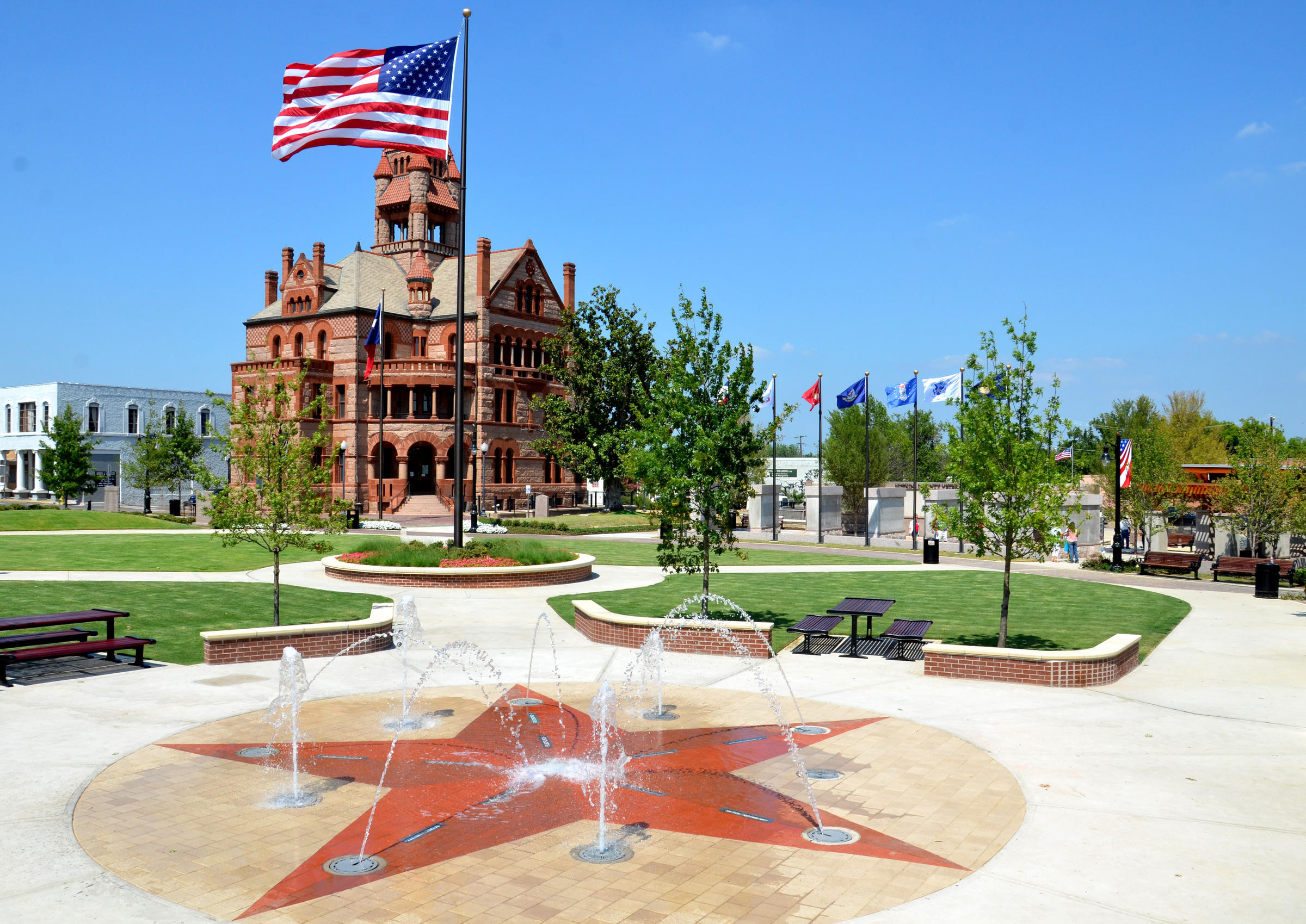
Celebration Plaza and courthouse in Sulphur Springs Texas

Day 5 · Wednesday, August 26

Daingerfield State Park → Sulphur Springs → Dallas

Piney Woods, a curious Texas square, and an early finish

Photo: URBE Studio
Depart7:30 AM CT
Arrive11:45 AM–12:45 PM
Distance155–170 mi
Day length4½–5¼ hr total
TimeCentral
7:30 AM

Leave Daingerfield at 95–100%

Take TX-11 through Pittsburg, Winnsboro and Sulphur Springs. Starting farther west makes this the easiest day of the trip while preserving the wooded, small-town finish.

9:30–10:15 AM

Sulphur Springs charge + Celebration Plaza

Charge, eat an early packed lunch and walk the nearby square: restored courthouse, Texas-star fountain, veterans memorial and the unusual one-way-mirror public restrooms.

11:45 AM–12:45 PM

Arrive in Dallas

The shorter final leg preserves a wide buffer before afternoon heat and traffic, with accommodations already secured through Sunday.

Dallas arrival protection
  • Join I-30 at or before Mount Pleasant whenever the Dallas ETA exceeds 2:30 PM.
  • Skip Celebration Plaza and charge only when Tesla requires it.
Open complete day route

Energy discipline

Use the Trip Energy graph, not rated miles.

The deliberate long intervals are Strasburg to Stuarts Draft via full Skyline and Dickson to Jackson via the Trace. Route the complete leg before leaving, preserve the listed arrival margin, and take the fallback charger whenever the forecast slips.

Tesla Trip Planner guidance
DestinationMinimum arrival
Ordinary Supercharger20%
Skyline / Trace charger25%
Claytor or Floating Mill25–30%
Village Creek30–35%
Daingerfield State Park45%
Dallas20–25%

At every campground

Connect first. Confirm the charge. Then settle in.

  1. 01

    Park fully on the assigned vehicle pad and inspect the receptacle for looseness, scorching or damage.

  2. 02

    Turn the breaker off. Seat the NEMA 14-50 adapter firmly, plug in, then turn the breaker on.

  3. 03

    Confirm approximately 240V and no more than the Mobile Connector's 32A limit.

  4. 04

    Recheck after several minutes. Reduce to 24A for unstable voltage, heat or a breaker trip.

  5. 05

    Stop after a repeated trip or abnormality; use the planned fallback charger.

  6. 06

    Set charging to finish near departure. Activate Camp Mode, then manually lock the Model X.

Load once

Small things that make five days easier

Tesla Mobile Connector + NEMA 14-50 adapter
Two clean refillable jugs for Hot Springs
Insulated cooler + frozen water bottles
Window shades, bedding, towel + folding chair
Insect repellent + headlamp
Tire inflator + repair kit
Offline Skyline and Natchez Trace maps
Campground confirmations + 50A screenshots